Skip to product information
1 of 5

LMX200 Ground Penetrating Radar (GPR) System

Regular price $37,722.30
Excl GST: $34,293.00
Sale Sold out
Taxes included. Shipping calculated at checkout.

SKU :

SKU:100-10-0148-AU

Model Type

Public utility systems and local governments require that the positions of underground systems are located and marked. This helps in planning projects and avoiding risks and hazards. The LMX200™ builds on the capabilities of the LMX100™ and adds further features to help you locate and map these utilities. It adds the powerful Grid Scan mode and the ability to use an external GPS to take full advantage of SplitView and MapView.

The LMX200SG system is an all-in-one, plug-and-play solution to add high-accuracy positioning to your LMX200 GPR data. The SG bundle unlocks powerful locating and mapping advantages while in the field and post-processing.

The LMX200™ allows data export for easy project archiving as well as post-processing and report generation with the optional EKKO_Project GPR data analysis software.

GNSS is an essential component for LMX150 / LMX200 workflows where accurate mapping, positioning, and survey data capture are required.

View full details

Rapidly locate metallic and non-metallic utilities

Enhance your productivity

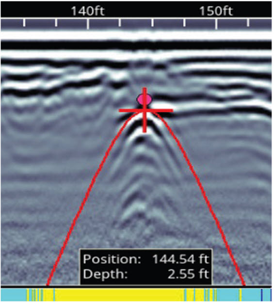
Pinpoint Depth & Location

LMX150 pinpoint depth and location screen

No complex settings. Just press Start and push the cart.

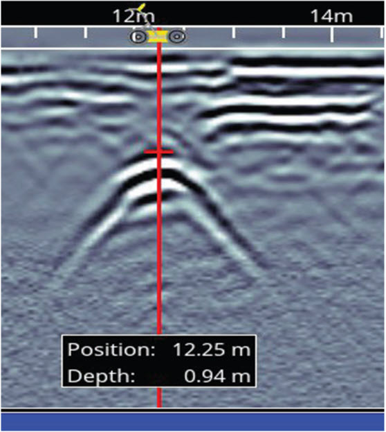
Easy Depth Calibration

LMX150 easy depth calibration screen

Use hyperbola-fitting to ensure accurate depth measurements and back up over the target to display its location and depth.

Increase your target confidence in the field with image optimisation

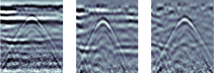
Preset Filters

LMX150 preset filters comparison

Adjustable Gain

LMX150 adjustable gain comparison

Optimize visibility of your targets with preset filters and gain adjustments.

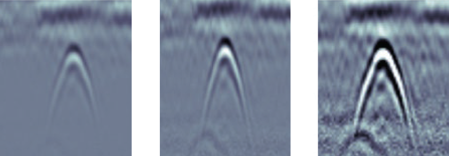
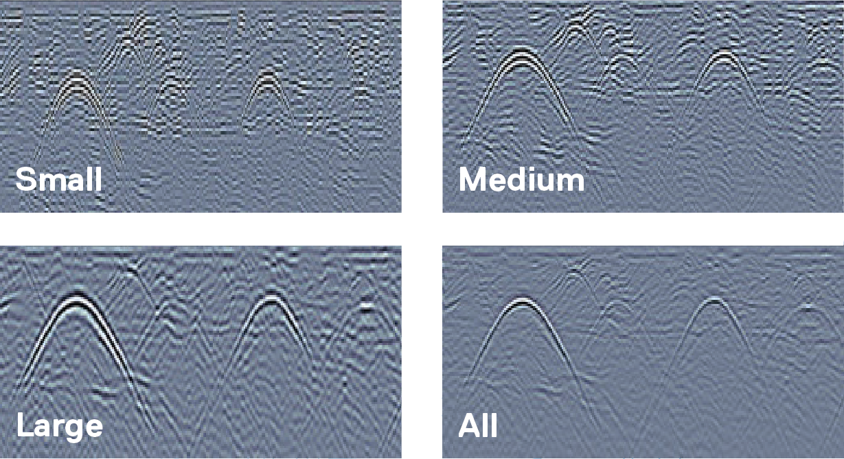
Dynamic Target Enhancement (DynaT)

LMX150 Dynamic Target Enhancement DynaT comparison

Enhance small, medium and large targets depending on your field conditions.

Grids & Depth Slices

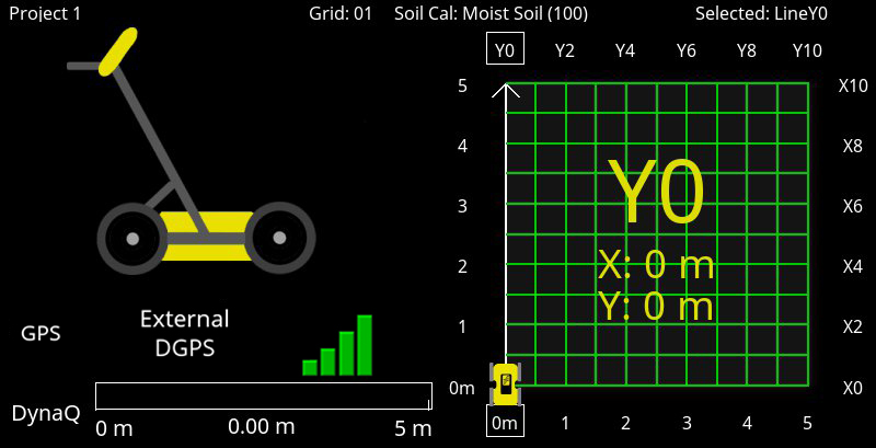
LMX150 guided grid collection screen

Flexible & guided grid collection

The LMX150 guides you through setup with pre-selected grid sizes. Stop lines early, or skip lines.

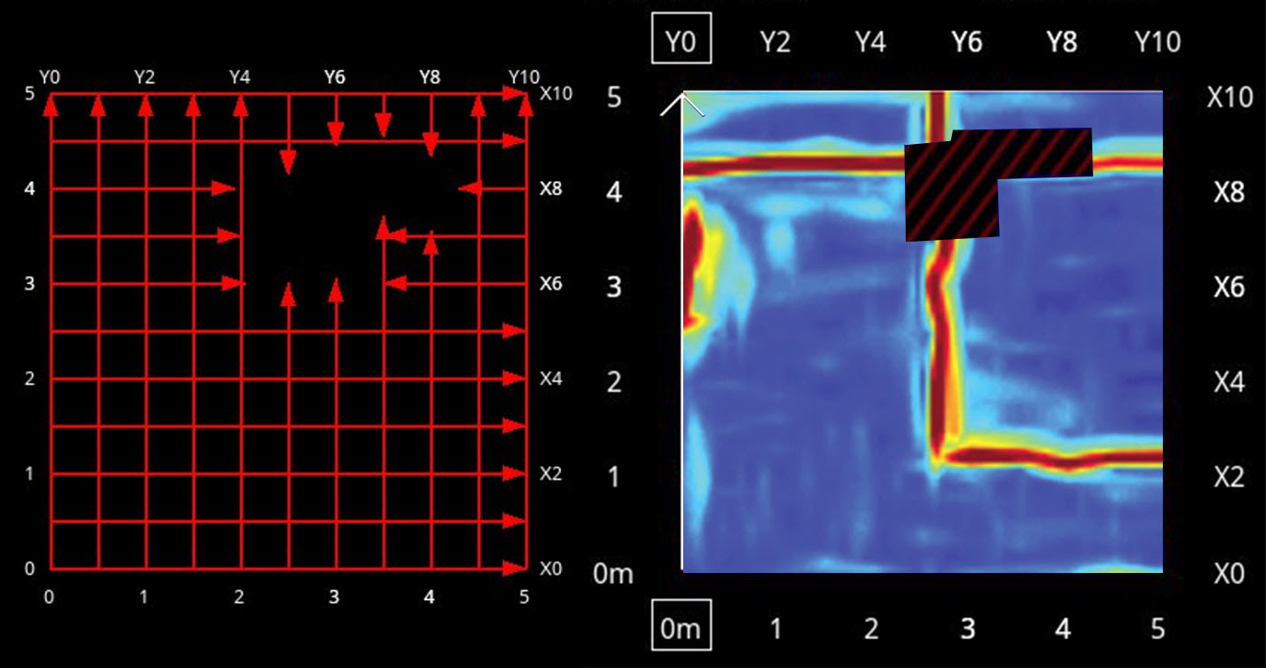
LMX150 obstacle avoidance grid screen

Obstacle avoidance

System guides data collection around an obstacle in your grid.

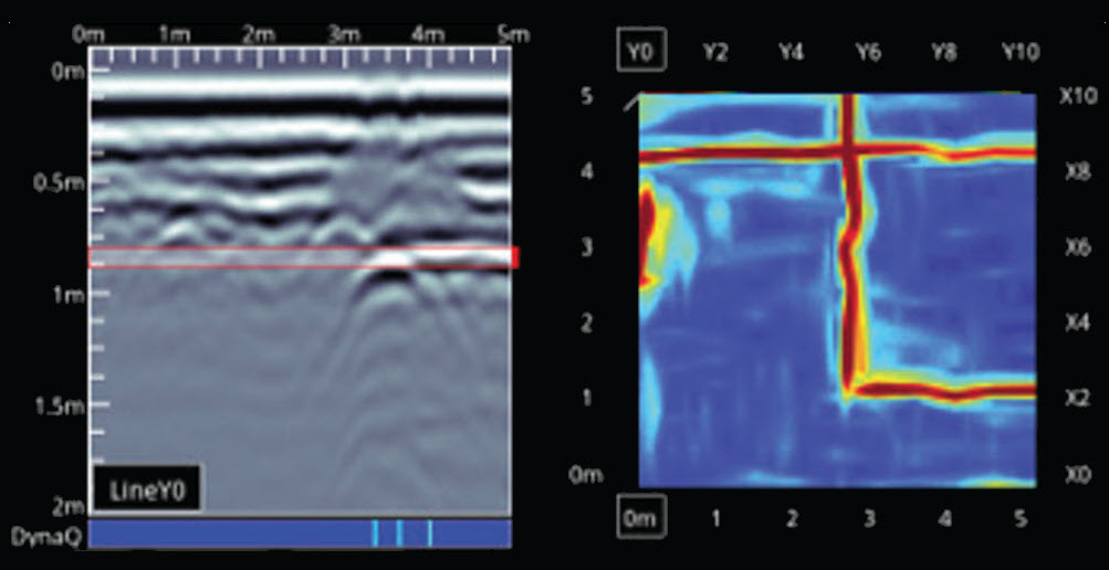
LMX150 in-field depth slices screen

In-field Depth Slices

Process grid data into depth slices and move down through your data to visualize targets at different depths on-site.

FEATURES UNLOCKED WITH EXTERNAL GNSS

Enhanced in-field locating

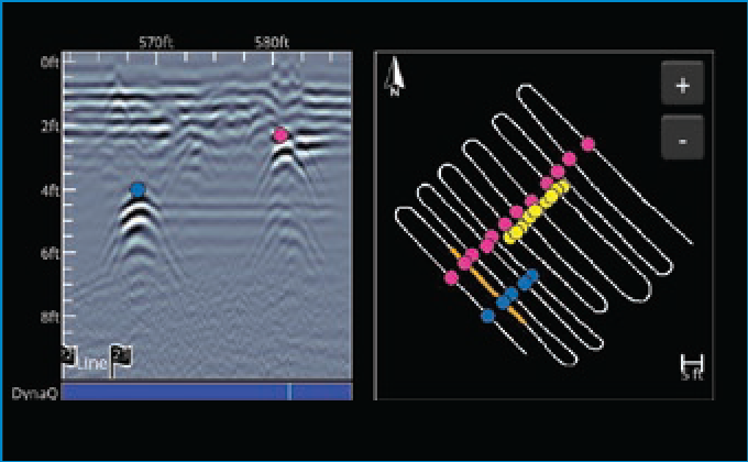
Instantly see interpretations in MapView as you add them to hyperbolas in the cross-section, helping to identify utility targets.

SplitView

GNSS SplitView screen

Instantly see interpretations in MapView as you add them to hyperbolas in the cross-section, helping to identify utility targets.

MapView

GNSS MapView screen

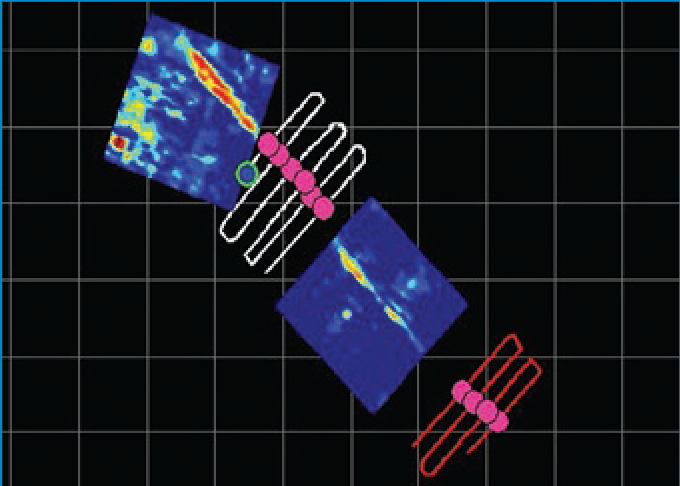
Visualize your entire GPR survey including depth slices, interpretation and flags to gain better understanding of complex locates.

Accurately map your findings

Export mapped findings in common file formats for GIS, reporting and third-party mapping applications.

CSV output

CSV spreadsheet export example

CSV file icon

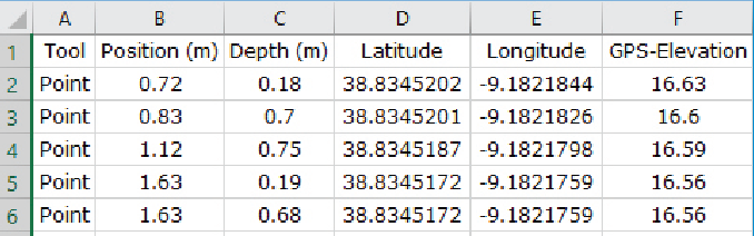
Spreadsheet .CSV file with georeferenced flags and interpretations can be used to create maps in third-party mapping applications.

KMZ output

KMZ file icon

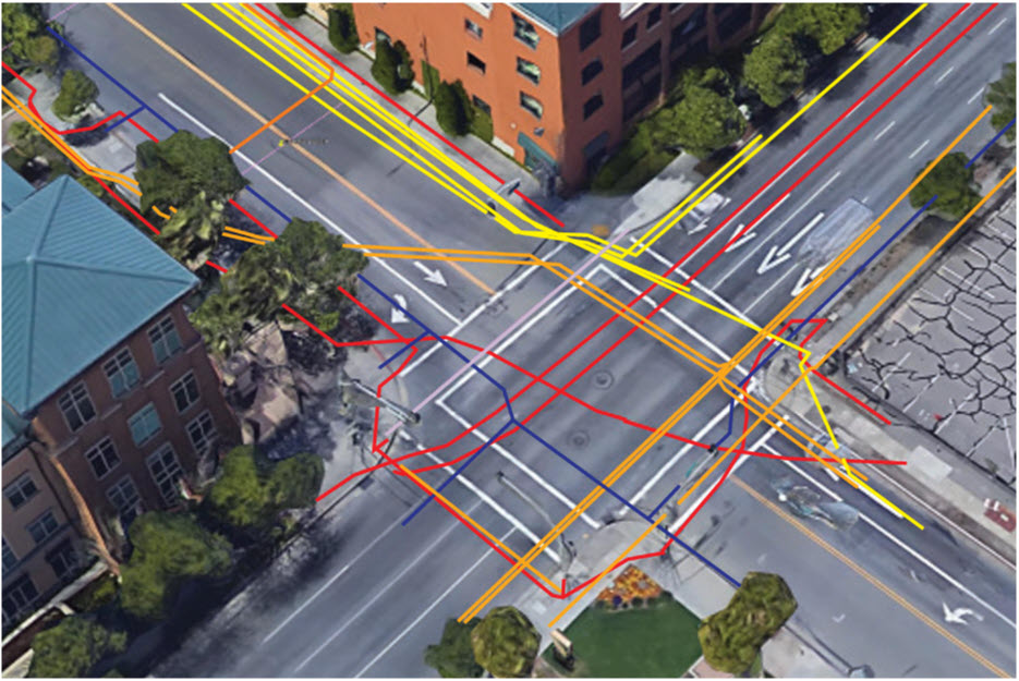
Automatic KMZ output of line, grid interpretations and screenshots, allowing utility maps to be easily created.

Enhanced in-field locating

Instantly see interpretations in MapView as you add them to hyperbolas in the cross-section, helping to identify utility targets.

Accurately map your findings

Export mapped findings in common file formats for GIS, reporting and third-party mapping applications.